Gas station nearby Eni Gas Station
Italy
Gas station nearby Eni Gas Station
Eni Gas Station
Viale Ulisse, 601, Catania Italia
contacts phone
:
+39
Latitude:
37.5326354
, Longitude:
15.1135508
read more
nearest Gas station
160 m
Stazione Di Servizio Agip-Eni (Agip-Eni)
Via Messina, 650, Catania
Gas station
read more
161 m
Eni
Via Messina 630, Catania
Gas station
read more
236 m
Erg
Via Messina 656, Catania
Gas station
read more
349 m
Laudani Alfio
Via Messina, 656, Catania
Gas station
read more
392 m
Esso
Via Messina, 684, Catania
Gas station
read more
404 m
Energia Siciliana (nautico)
Via Carlo Porta, Catania
Gas station
read more
412 m
Di D'Agata Maurizio (Agip-Eni)
Via Messina, 630, Catania
Gas station
read more
424 m
Fichera Marcello
Via Messina, 684, Catania
Gas station
read more
803 m
Q8 easy
Viale Enzo Longo, Catania
Gas station
read more
917 m
Q8easy
Via Galatioto, 57, Catania
Gas station
read more
927 m
Q8
Via Re Martino, 229, Catania
Gas station
read more
951 m
Tamoil
Piazza Duca di Camastra 1, Catania
Gas station
read more
1.009 km
Saraniti Gaetano Vittorio
Piazza Duca di Camastra, 18, Catania
Gas station
read more
1.1 km
Esso
Via Nuovalucello, 172, Catania
Gas station
read more
1.127 km
Esso Gpl
Via Sgroppillo, 25, Catania
Gas station
read more
1.206 km
Gas-Point
Via Nuovalucello, 172, Catania
Gas station
read more
1.241 km
Luccarelli Antonino
Via Firenze, 223, Aci Castello
Gas station
read more
1.645 km
Barbagallo Angela
Viale Polo Marco, 16, Catania
Gas station
read more
1.648 km
Stazione Di Servizio
Viale Marco Polo, 46, Catania
Gas station
read more
1.677 km
Eni
Viale Marco Polo 46, Catania
Gas station
read more
1.721 km
Eni
186, Viale Vittorio Veneto, 184, Catania
Gas station
read more
2.033 km
Q8
Viale Vittorio Veneto 115, Catania
Gas station
read more
2.154 km
Eni
Largo Carnazza 2, Tremestieri Etneo
Gas station
read more
2.252 km
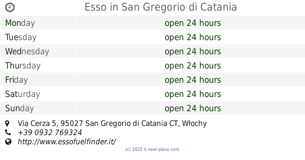
Esso
Via Cerza 5, San Gregorio di Catania
Gas station
read more
2.253 km
IP
Via Vincenzo Giuffrida, Catania
Gas station
read more
📑
all categories
Accounting
Administrative area level 1
Administrative area level 2
Airport
Amusement park
Aquarium
Art gallery
Atm
Bakery
Bank
Bar
Beauty salon
Bicycle store
Book store
Bowling alley
Bus station
Cafe
Campground
Car dealer
Car rental
Car repair
Car wash
Casino
Cemetery
Church
City hall
Clothing store
Colloquial area
Convenience store
Country
Courthouse
Dentist
Department store
Doctor
Electrician
Electronics store
Embassy
Finance
Fire station
Florist
Food
Funeral home
Furniture store
Gas station
General contractor
Grocery or supermarket
Gym
Hair care
Hardware store
Health
Hindu Temple
Home goods store
Hospital
Insurance agency
Jewelry store
Laundry
Lawyer
Library
Light rail station
Liquor store
Local government office
Locality
Locksmith
Lodging
Meal delivery
Meal takeaway
Mosque
Movie rental
Movie theater
Moving company
Museum
Natural feature
Neighborhood
Night club
Painter
Park
Parking
Pet store
Pharmacy
Physiotherapist
Place of worship
Plumber
Point of interest
Police
Political
Post office
Premise
Real estate agency
Restaurant
Roofing contractor
Route
Rv park, camping
School
Shoe store
Shopping mall
Spa
Stadium
Storage
Store
Subpremise
Subway station
Supermarket
Synagogue
Taxi stand
Train station
Transit station
Travel agency
University
Veterinary care
Zoo
administrative area level 3
sublocality level 1
↑